
Are you lost?
It’s impossible; GPS will show you the way — for now.

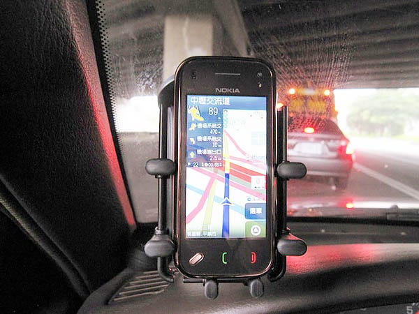
Where in the world would we be without GPS? We use it everyday just by getting in our cars or turning on our smartphones. Some people are probably addicted to it by now, while others we know are always getting hopelessly lost without it. Anyway, who wants to go back to using those bulky Rand McNally atlases or impossible-to-fold road maps? Remember when we used to stop at a gas station, just to ask an attendant for local directions?
GPS is not just for finding the right exit off the highway or the address of somebody’s home or office. Commercial airlines navigate with GPS. Outdoor wilderness hikers carry battery-operated GPS devices so bears don’t eat them and open sea commercial fishermen use it to get back to a safe harbor. How do you think that pizza you just ordered got delivered to the right address?
The Artemis astronauts that just circled the Moon were guided by GPS signals. And, just so you know, Amazon and Google know exactly where you are standing when you open a map on your cell phone. For all we know, some GPS device is probably tracking our whereabouts while we’re sleeping.
Can you think of a better use for the adjective, “ubiquitous?” If George Orwell’s 1984 Big Brother had a better surveillance device, it could not have surpassed our current GPS system.
And, not to put a big chill on this topic, but GPS is how all those drones being launched over Ukraine and the Middle East find their targets or explode into one another in the smoke-filled skies over these modern war zones. GPS kills people, folks.
How does it work?
GPS stands for Global Positioning System, in case you forgot or never knew. Who do you think invented GPS and who owns it? Lots of people confuse GPS with Google Maps. And, while there are hundreds of commercial services that use GPS, the base source of GPS is owned by United States taxpayers as part of the Department of Defenses’ Space Force.
The U.S. government launched its Global Positioning System in 1973 as a major improvement over previous navigation systems. The system uses an array of 31 Navstar orbiting satellites. Russia, China and the European Union all have their own GPS spaced-based radio navigation systems with their own constellations of satellites. This mass of low orbiting hardware makes for a very crowded sky, 12,250 miles over our heads. All of these GPS services share their signals with one another and make it available to everyone in the world. Together this system is called GLONASS (Global Navigation Satellite System.)
Many corporations make special GPS-worthy computer chips that are embedded into everything from our phones, cars, watches and kitchen appliances, to FIFA soccer balls and aboard the International Space Station.
A GPS receiver operated by a user on Earth measures the time it takes radio signals to travel from four or more satellites to its location, calculates the distance to each satellite, and from this calculation determines the user’s longitude, latitude, and altitude. This takes milliseconds. And that’s how that blue dot appears on your phone or computer screen to remind you where you are. It’s also the same technology Ukraine freedom fighters use to attack an oil depot on the outskirts of Moscow.
According to the Federal Aviation Agency (FAA), which manages the U.S. side of the GLONASS system, the GPS system is accurate within 10 feet and has a 95 percent accuracy performance rating. This works okay for us daily commuters and Google Map users, but the FAA also operates a Ground-Based Navigation system (GBN) to assure more accuracy for air travel and military uses. GPS guided radio signals are also used by international financial entities to keep exact timing and recording of the billions of daily monetary and market transactions.
Until about 1999, the federally-controlled GPS network was mostly dedicated to military use. For national security reasons, a less accurate model was first made available to general public use. Maybe you remember the early versions of citizen GPS from the Garmin and Tom Tom companies. They sold those little computerized boxes you could glue onto your car’s dashboard for navigation. Garmin also sold battery-operated GPS devices for athletic and outdoors recreational uses.
All future wars are GPS-based
A world that now spins around the Sun with the full accompaniment of all those GPS systems is just like the rest of our modern civilization that is now addicted to increasing automation and computerization: there is no going back. Our GPS future does not offer a “cold turkey” alternative. Things may get very ugly soon, but no one wants to admit it, right now.
“Recent conflicts, from Ukraine to the expanding use of Iranian-designed drones, are exposing a fundamental vulnerability,” a recent article in Forbes magazine reported. “Electronic warfare units now routinely jam and spoof GPS signals across large portions of the battlefield. In some areas, drone operators report signals so unreliable they must revert to visual navigation. What was once a background capability is now a contested domain.”
Hundreds and thousands of unmanned drones are being launched at targets in today’s war zones over Ukraine, Russia, Iran, Israel and other parts of the Middle East. Most of the attacking drones are being shot down by defensive drones. The daily victors are the military units with the best GPS systems — or the best GPS-jamming signals.
“The United States pioneered satellite navigation, and GPS will remain foundational for decades,” also reports Forbes. “But the lessons from today’s conflicts are unmistakable. In a world defined by drones, autonomy and electronic warfare, reliance on a single system is a liability.”
Our question is, will all this “weaponized” GPS ruin civilian access to GPS in the future? Right now the Strait of Hormuz between Iran and Oman is being controlled by not who has the most bombs or biggest military but by whoever has the best jamming and spoofing GPS radio signals to control ship traffic and the overhead air space.
Within 24 hours of the first US-Israeli strikes on Iran on Feb. 28, ships in the region’s waters found their navigation systems had gone haywire, erroneously indicating that the vessels were at airports, a nuclear power plant and on Iranian land, reported CNN at the time.
Obviously, whole new systems of GPS protections are needed, and indeed there is a “GPS race” between governments and others to build new enhanced security features for military and non-military uses alike.
Recently, all the air traffic over Newark International Airport was scrambled and the airport was shut down for several hours. Later, it was discovered that the culprit was a commercial truck driver on an adjacent interstate highway using a GPS jamming device so his employers couldn’t track his hourly routes and unauthorized stops.
As if all this isn’t bad enough, coming soon will be GPS systems aided by Artificial Intelligence. Far away from any battlefield, AI-boosted GPS will soon be co-piloting your automobile or your next Amazon delivery with improved route optimization, predictive analytics, and real-time decision-making. AI-powered GPS trackers will analyze traffic patterns, suggest alternate routes, and even detect unusual vehicle behavior.
All we can say is, lean back and enjoy the ride.
— Rollie Atkinson
7-11-2026
"jamming device so his employers couldn’t track his hourly routes and unauthorized stops."... strip clubs? lol Great article Rollie.
Thanks for the knowledge without an agenda. One more advantage to being old- not my problem 😉